
Dixon Ford (AKA “Hailstone”)
Click here to get directions
Parking GPS: 35.825452728865926, -93.46266790995446
Description
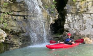
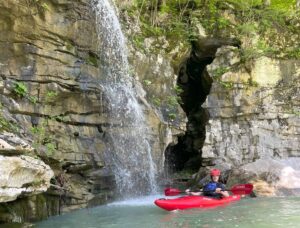
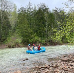
This is the start of America’s first national river and is a classic setting for an Ozark Experience. A clear clean river with cascading waterfalls along the banks sustaining a wide variety of native vegetation that adds a rich beauty to this already awesome wilderness area. Wildlife and birds far outnumber people on this stream. It usually only flows when the weather is cold, but in the fall, when the seasons are changing, the Hailstone River is a place of even more spectacular beauty. Once you start you will be out of cell phone reception and any easy way to get back to civilization so be prepared.
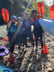
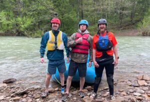
Be sure to bring your camera, when you are not dodging boulders, sheer canyon walls, undercut rocks, ledge, dead-fallen trees or other widow makers you will want to capture some memories.
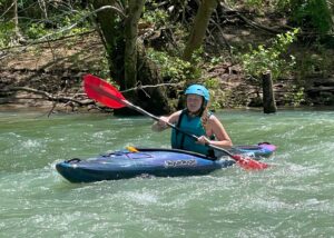
Remember, the water rises and falls fast on Hailstone. If you start at 4 feet at the Boxley gauge you will be dragging in a couple spots and you will finish at 3.5 feet. We did it at 4, 4.5, and 5. Our next trip will be at 6! Remember, the water is faster the higher it is. Be careful!
Dixon Ford put-in turnoff (9100) is a few miles south of the 21 and 16 junction. Look for road 9100. You will go down road 9100 for a couple of miles to the put-in. This road can get rough in the rainy season and a higher clearance 4×4 would be best. A tall 2-wheel drive could get it done in the dry season, but in the wet season you would want a friend in a 4×4 with you just in case you got stuck.
Park your shuttle car/truck at the Boxley bridge for a 15.5 mile float. You will do about 3 miles an hour on this section of river. A little faster if the water is higher, slower if the water is on the lower side.
The road on the other side of the Buffalo River at Dixon Ford is absolutely 4×4 only so if you go when the river isn’t flowing good it’s a great place to have some 4×4 fun.
Class Rating
II – III+ w/ Class IV consequences
Length to next put in/take out
15.5 miles
Time to next put in/take out
4-5 hours
USGS Gage to watch:
Boxley Gauge
Current Gage Level
https://waterdata.usgs.gov/monitoring-location/07055646
Gage Level and condition of float
- Minimum level: 4 – 4.6 feet
- Optimal level: 4.7 – 6 feet
- Maximum level:9 feet
Best times of year:
November through May after heavy rains
Camping Facilities:
Primitive – Click here for camping info
Location:
Dixon Ford campground on county road 9100, Pettigrew, ar.
Directions from Jasper Arkansas Ozark Cafe:
Click for map and directions


Explore with
confidence
Inspiration and guidance for wherever your trail may lead.